

Transcription
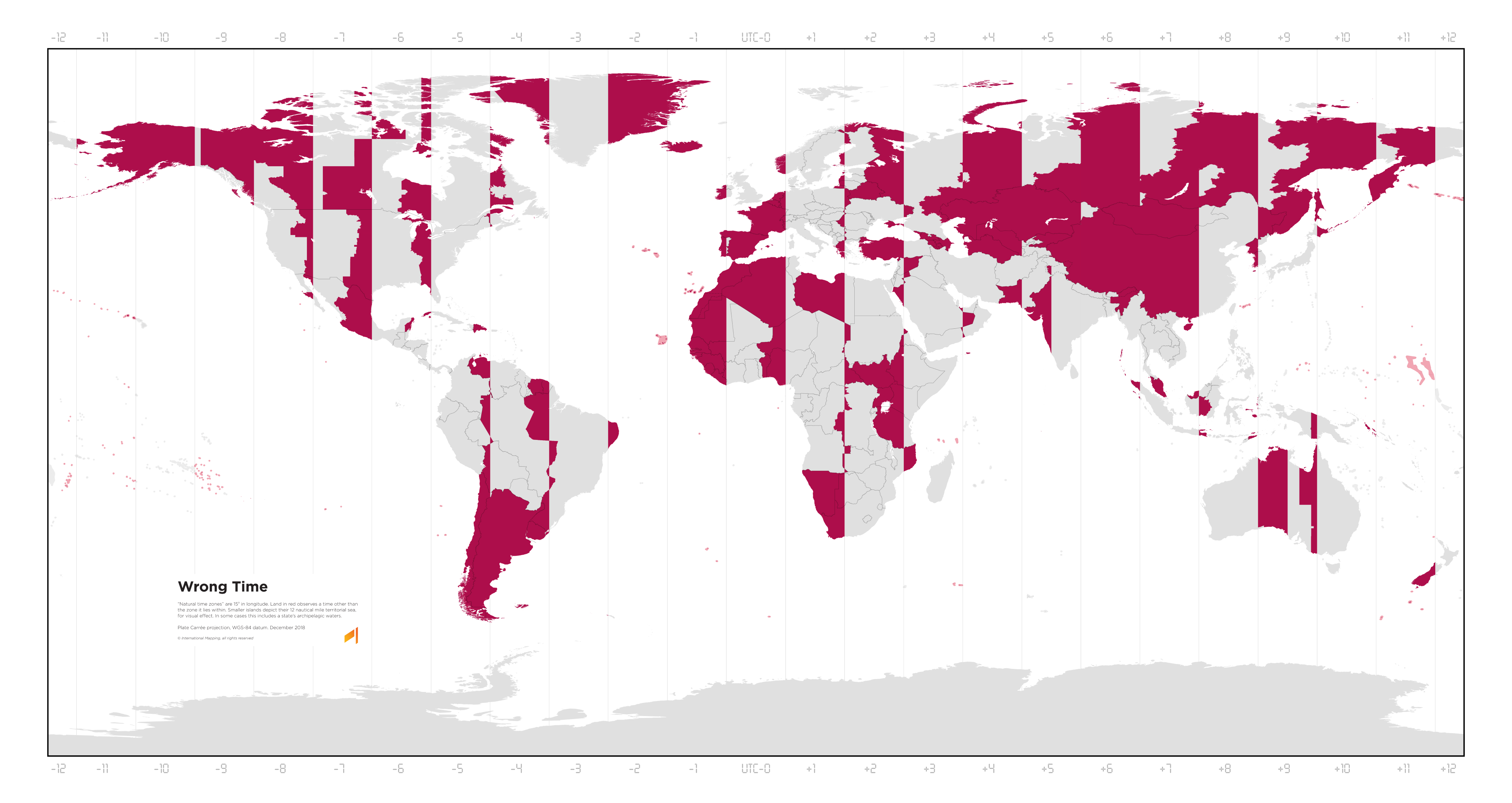
A map of the world with vertical lines marking the time zones from UTC-12 to UTC+12. It has a legend:
Wrong Time
“Natural time zones” are 15° in longitude. Land in red observes a time other than the zone it lies within. Smaller islands depict their 12 nautical mile territorial sea, for visual effect. In some cases this includes a state’s archipelagic waters.
Plate Carrée projection, WGS-84 datum. December 2018 © International Mapping, all rights reserved.
France, Spain, Belgium, and the Netherlands are in the wrong time zone because of Nazis https://lemmy.ca/post/2220899
That doesn’t exactly explain why they’re still in those time zones 80 years later, despite only having been under Nazi control for less than 6 years.
Not only that, most of Spain (except the Canaries), the most extreme case, Is on a time zone that has a border with Russia, while actually being on the Greenwich meridian.